Mount Connection

Tuesday 12 October 2021


From Pulpit Rock  with  view to Mount Montagu

The start along the Big Bend Fire Trail is now nicer to walk on than in prior years. Once at the junction with the walking track it becomes nice walking country. We stopped at the copse of trees part way over the plain of the headwaters of Mountain River, where there is a rather pleasant open spot amongst the trees. From there the track sidles up the top of Mount Connection. At this point the track was left to visit The Lectern and then Pulpit Rock ,all in nice alpine vegetation including snow gums,. As always the return part that on the ascent of the fire trail was tedious and felt like the hardest bit of the walk.

All up it was 10.3k 5:40.

Collins Bonnet


A photo album is here.


Route profile

For some strange reason when the data from the phone app is downloaded the distance is not correct. it is 10.3k   and not the 11.2 shown above


Route from track to The Lectern and Pulpit Rock


Posted in bushwalk | Leave a comment

Gunners Quoin 2019

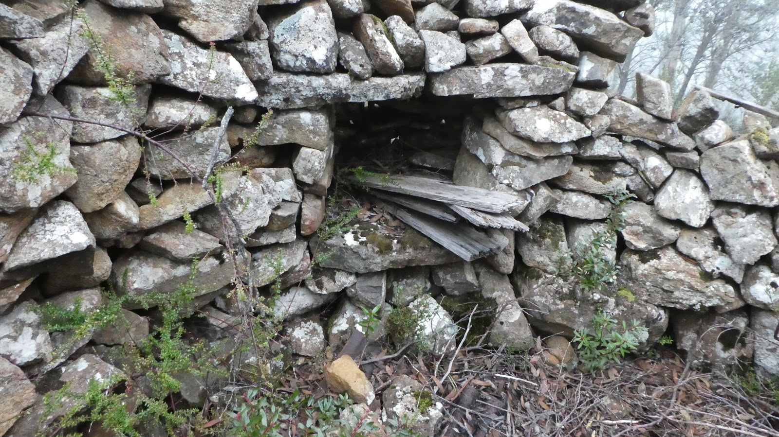
Tuesday 30 July 2019

There were a few hiccups on the way and all down to me, well almost all.

I had a series of coordinates on the GPS and was also aware that the batteries didn’t have a lot left in them. But I forgot to bring the spares and started being frugal with using it. But this was a contributing factor in my first bungle.  The other mistakes were forgetting to bring a cup and teabag, not having spare batteries and, as explained below, not being patient enough with my GPS.

The route taken was up a steep hill and whilst on top I decided to take a track leading off earlier than planned. It was nice country eventually brought is to a vehicle track, which turned out not to be the one I thought it was. Turning the GPS on solved bungle number 1.

Ozothamnus on hill top plateau


Morning break on top of hill with view Gunners Quoin.  Photo from Dave Tucker

Once back on track all went relatively OK, until a fence was reached, and it seemed that resorting to the GPS would be helpful. However, it seemed to be flat, but although my phone map was useful it did not compensate for not having the coords for an old vehicle track. Nevertheless, we got to Gunners Quoin without a problem.

As the walk was taking longer than expected, it was decided to take the quickest route back and we get there with half an hour to spare before the gate to Risdon Brook gate was due to close.

Gunners Quoin


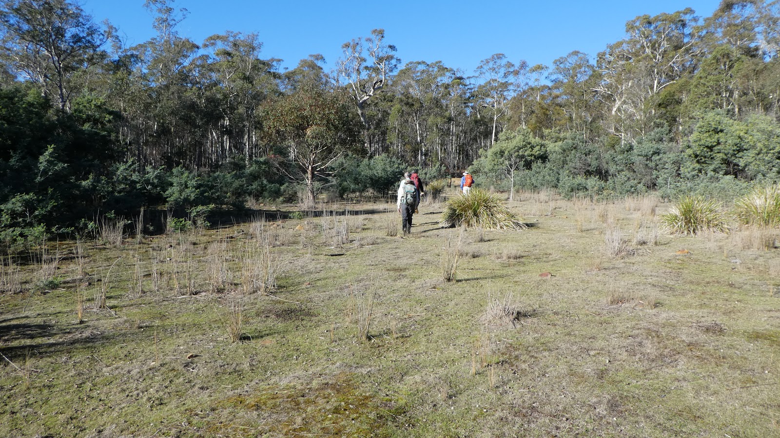
Grasstrees on Meehan Range

When I got home and downloaded the track from the GPS I discovered that I must have been too quick in thinking the batteries were flat when I had turned it on for navigation, because from that point until Gunners Quoin our track displayed on the map. I could have used the GPS to locate the old track after all.

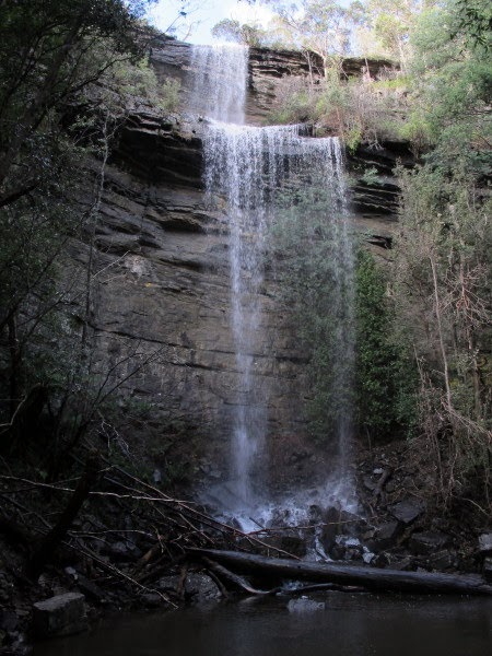
However, the walk itself was good, the morning was sunny and without much wind and the bush was delightful.  Near the top of the first hill we were greeted by a cacophony of Yellow-throated honeyeater calls and masses of Ozothmanus bushes; perhaps the former like living amongst the latter. Morning break on a hilltop was carpeted with casuarina leaves and had panoramic views of Gunners Quoin.  By lunchtime on the Quoin it had become a bit cloudy, but this was compensated by calm conditions and three Wedge-tailed eagles flying past; one of which came closely overhead providing an exciting site.


Map of route 2017 and 2019


The tracks from a walk in 2017 and this one  in 2219 are shown.  Part of the 2019 track is absent as the GPS was off for part of the walk and only a few points exist from where it was briefly turned on.


Posted in bushwalk | Leave a comment

Mount Arthur

3 and 6 January 2019
It took two attempts to locate the SAMA hut on Mount Arthur.  All the cairns and a real maze of pads there didn’t help either.

Spice bush (Ozothamnus ledifolius) Mount Arthur


On the first trip I though the hut would be easily found.  But right from the start things didn’t go as expected because I used a pad which I thought was the one used just a few weeks ago, only to find myself above the Scout Hut rather than below as before; somehow missed the junction. Then when looking for SAMA hut pads were followed but none seemed right. Eventually it was decided that the pad we were on was the one that went below cliffs to Lost world, so didn’t continue.  There were numerous pads and cairns about often going nowhere. Eventually we decided to leave and come back armed with coordinates and
a GPS.
Once the map and the various bits of data were viewed it became quite apparent that SAMA and the pad to it was further to the east by about 100 metres. On this second visit with coordinates in the GPS it was quite easy to get to the hut and the it was virtually a clear track and appeared to match our memory. The hut log showed it gets plenty of use, including many overnighters. It was also well maintained inside and the floor swept clean.

SAMA hut


Rather than returning the same way, we went cross country to the Lost World track then picked up the track, sometimes known as yellow dot track to the edge of the cliffs. I remember on one occasion coming this way with David Hardy and descending to the Lost World, but on looking at the chimney at track end had me wondering what way we
got down.

Chimney, some bolts are visible


During the two walks here we encountered some strange things, at least they were to us.  On the first day we heard a loud repetitive voice and then spotted a person standing on a large rock and as we got closer it seemed he was chanting with arms raised. Not far away was another person sitting on a rock with a rug which he pulled over his head.  Now it was quite a warm day, so it probably wasn’t because of cold conditions. To top it off, from another direction we could hear loud persistent voices making ludicrous sounds, from about where the Lost World track is located.
Then on this second journey, whilst we were going cross country, two people were spotted walking up a track with the second one singing and holding a phone up in front of herself. Was she taking a video of the walk or a selfie; could have been either. 


Posted in bushwalk, bushwalking, cliffs, hiking, mountain, outdoors, Tasmania, tramping, trekking, Wellington Mount, Wellington Park | Leave a comment

Colourful Scoparia

Shadow Lake

26-27 December 2018

After enjoying the walk through the high valley between Mount Rufus and Hugel in April 2016, we decided it would be a good time to visit again when the scoparia was in flower. Our initial plan was thwarted by the weather, but two weeks later it seemed ideal and we set out, but with a different strategy.  Instead of three days we opted for two with the intent of walking to the valley on the second day and then collecting the tent on way back and continuing to the car at Cynthia Bay.  This worked out well and as the first day was only as far as Shadow Lake, we stopped at The Wall in Derwent Bridge, where we also had lunch.   The carvings at The Wall are now almost complete.

Eucalypt


Waratah at lake shore


Shadow Lake shore


Forgotten Lake


Boronia citriodora Lemon-scented Boronia


Richea scoparia


Richea scoparia


Boronia citriodora Lemon-scented Boronia


Richea scoparia


Richea scoparia


Richea scoparia


It was warm going up to Shadow Lake where we used a very sheltered campsite, cooked tea then took a stroll to forgotten Lake. The effort of what was a half day of walking was enough to make us both sleep very well.


On a fine morning we got away at 8am and were rewarded first by masses of lemon scented boronia in flower (B citriodora) then the scoparia (Richea scoparia) started to come into view and only got better the further and higher we went.  At the top of the valley it widens and flattens, and it was here that the scene was a riot of colour. Off to the north side, where the land dips, the scoparia was higher and the most floriferous with a mixture of colours.


Total distance 24k


A photo album is online
 

Shadow Lake

Shadow Lake

Posted in bushwalk, bushwalking, forest, hiking, mountain, outdoors, Tasmania, tramping, trekking, wilderness | Leave a comment

Two out of Three

Waterfalls On Marriotts Creek

Tuesday 11 December 2018

It was hoped to visit the three waterfalls on Marriotts Creek. This arose following an enquiry about the third waterfall at Marriotts. It prompted me to look back at my old slide photos and I do have one which I have scanned.  It is marked as the third waterfall and it does look smaller that the other two falls, which is the way I remember it.  However, it looks more impressive than my memory, but it was taken in 1986 or early 1987 so it is hardly surprising my memory of it is not that good.

The first waterfall – Marriotts Falls

It is not a long walk but it was more convoluted getting to the second falls than I remembered and by then 2 hours had elapsed. As the distance and time that would be need to get to the third falls was unknown, a decision was made to go no further.

Second waterfall on Marriotts Creek
Base of tree. I didn’t notice the graffiti until I looked at the photo

Often it is shady at waterfalls but below the second fall on Marriotts Creek it was pleasantly light and sunny, although on this warm day we chose the dappled shade at the edge for lunch. The falls were quite spectacular and high and we considered them better than the first waterfall.

Elapsed time for the walk  was 5:40 for 10.3k
A photo album from the day is here, it also has an option to view the location on a map.

Waterfalls on Marriotts Creek

Waterfalls on Marriotts Creek

Posted in bushwalk | 1 Comment

Curio Bay

Thursday 12 July 2018

After reading Dennis Jeffery’s account of a walk to Tumbledown Point, I decided to use his return route as the basis for getting to Curio Bay. Once past the farm there was a gate on our right, but the wide track we were on continued ahead. It seemed more likely that this should be followed, but after a short distance the waypoint aimed for wasn’t any closer and pointed of to the southwest.  

Wave at Curio Bay

Nevertheless, as the track meandered it got closer for a period and maybe the track would bend towards it in due course, but it still seemed a long way distant.  Eventually it became apparent that we were going in wrong direction, and this became very apparent when the park boundary sign loomed up. It was quite some backtrack to do, a bit over 2k and over an hour lost, before we were back on track at that gate.   I should have taken more care when first getting there and followed the GPS.

A pad was discovered that bypassed the gate and as soon as this ended there was a big blue sign indicating Tasman National Park. All was straight forward from then on until reaching the Curio Bay junction. The walking between these two spots was nice with a variety of forest type and long flat ridge top sections making pleasant walking. 
At the Curio junction however it wasn’t so pleasant. An overgrown pad went through very wet bushes and resulted in us getting lots of it on our clothes. The dominant bush was Calytrix and I have never seen so much of it before. When Curio Bay finally came in sight a rough pad lead down to rocks and they provided a sunny dry spot for lunch.
Curio Bay comes in sight
Masses of Calytrix


Return was without incident and took 1:45 for the 6.3k.  

Curio Bay

Curio Bay

Posted in bushwalk, bushwalking, cliffs, hiking, outdoors, Tasmania, tramping, trekking | Leave a comment

Huntingdon Tier

Tuesday 19 June 2018

Huntingdon Tier is a sandstone hill area just east of Harry Walker Tier but is predominantly private land. Some cliffs and rock formations are visible from a distance and the walk went to some of these. Locations were picked out after looking at a map and satellite images and one of the first of these was a narrow gully penetrating well into the tier. This spot turned out to be the highlight of the walk.
 
Fretted overhang roof
 
As we
approached what seemed to be a cliff was visible through the trees and on getting closer the scene became impressive, with large overhangs and caves on the other side of the gully. Descent to the floor of the gully passed cliffs as we crossed through deep green mossy rocks under Pomaderris to the cliffs.  This side the sun was warm and lighting all the features. It was a short scramble to get to the floor of the largest cavity and from there we went further up the gully passed other caves and ascended to the clifftops.


Overhang on the eastern side


One of the clearings being reclaimed by nature


Huntingdon Tier summit
 
The route from there went via the western side of Huntingdon where there were some smaller but nearly as impressive cliffs. An old track was used for part of the return walk, before branching off through to old cleared areas that were now being reclaimed by silver wattles and other vegetation. A direct line was then made for the summit (545m) before descending through the bush to the track and on to the cars.
 
This walk is on private property so permission from the owner is needed.
 
A photo album is online
 

Huntingdon Tier

Huntingdon Tier

Click image above to view


Map showing Huntingdon Tier


Posted in bushwalk, bushwalking, caves, cliffs, forest, hiking, outdoors, Tasmania, tramping, trekking | Leave a comment

Echo Sugarloaf

Sunday 10  June 2018
With such a nice day expected we made plans to visit Echo Sugarloaf.  As it is only a short walk  we had plenty of  time to stop for a coffee at Cygnet, and also made the walk slightly longer by starting at the western end of Randalls Bay.  It proved to be a good decision as there is no parking where the track starts.
Echo Sugarloaf from Randalls Bay


Dam Pond   passed on the way


Randalls Bay from Echo Sugarloaf
 
The reserve is 122 hectares and was donated to the state by local farmers, Max and Bev Thomas, for the protection of endangered species. Randalls Bay Landcare built a track which opened in 2018 and climbs quite gently most of the way by following the contours of the area. It does result in being about 300 metres distance from the top near the start but by the halfway mark you are 700 metres away.  A pond with a well constructed platform is passed on the way.


Our versionof the walk was 6.3k and took 1 ¾ hours of walking.


Posted in bushwalk, bushwalking, cliffs, forest, hiking, outdoors, Tasmania, tramping, trekking | Leave a comment

Patrick Again


Mount Patrick

Tuesday 29 May 2018
Neville hadn’t been to Mount Patrick and was keen to go there. Greg and I had been there before, but the previous excursion couldn’t have been too off-putting as we also went on the walk. 
The day was predicted to have a few showers, but there was only two extremely brief episodes. However, there was quite a bit of mist about in the higher altitudes. Once the turnoff to Patrick was reached the scrub was quite thick and part way through, when thick tea tree thickets were reached, many were broken back to mark the route. There were tapes as well to mark the route as it wended about, and this continued virtually all the way to the top. It took us 55 minutes to reach the summit, which was 5 minutes longer than in 2012 and perhaps indicating that the scrub slowed us down as well as being 6 years older.

Georges Flagland


Hut ruin on summit


Bush at Mount Patrick summit area


The old hut site near the top of Mount Patrick seemed to be in much the same condition as on previous visits, except there was now no sign of the window. In the cool conditions on the day, it made an ideal spot to gain shelter during our lunch break.
The route makes an interesting quandary for the management perspective. The first half is clearly getting denser and more overgrown, resulting in much breaking of bushes and taping  
The walk commenced on Jefferys Track at a point where it would have been unwise to drive further.  This made the walk 17.k return with a walking time of 5 hours.


Posted in bushwalk, bushwalking, mountain, outdoors, Tasmania, tramping, trekking, Wellington Park | Leave a comment

Flora at Last

Floras Falls – Silver Falls

Tuesday 15 May 2018
Following information that identified where
floras Falls were, the incentive to make a visit was strong. The official name is Silver Falls and when we were last looking for Floras we had the intention of going to Silver Falls to check, but lost enthusiasm.  It was just a short distance  from where we had parked the car below Collins Cap.
Prior to our walk the area had been subject to very heavy rain, causing flooding in Hobart. Now four days later there was a good flow in the creeks and Silver Falls Creek could be heard as we started to  descend the steep slope of the reserve, then cascading water came into view. After 25 minutes the top of the falls and it was obvious that this was a significant waterfall, with plenty of water flowing it was in fact quite stunning.

Upper section
The falls are in an amphitheatre and in 3 sections totalling some 45 metres in overall height drop. He first drop has a sizeable overhang making it very easy to walk behind, whilst the second is on bands of sloping benches.  It is a bit more of a descent to reach the bottom as some cliffs have to be skirted, but here the drop is the biggest and large pool lies at the base.

Top taken from north bank


Under top fall from Jon Marsden-Smedley


Middle falls


We were all most impressed by the scenic nature of the waterfall and felt that it was deserving of more visitors. The slope in and out is quite steep, but by taking a slightly wider path to the north it would be not that difficult to create a track, although some rock would need to be used for steps in parts.   The route could also be made easier by contouring more towards the cascades and crossing below them.
The walk was a mere 3.2k and took a little over 2 hours.
 
Thanks to Martin Stone for the the location of the falls.
Top and bottom of falls


Silver Falls from Bruce Champion


Pool at the bottom

There is a photo album from the walk which includes the 1905 photos


Floras- Silver Falls

Floras- Silver Falls

Posted in bushwalk, bushwalking, cliffs, hiking, Tasmania, tramping, trekking, waterafll, Wellington Park | Leave a comment